
An Ohio University researcher is helping pull self-driving cars out of sci-fi and into southeast Ohio
By: David Forster
Posted on:
ATHENS, Ohio (WOUB) — Advances is technology have pulled self-driving cars from science fiction into reality, with companies like Waymo launching autonomous taxis in places like San Francisco and Phoenix. A researcher at Ohio University is taking the lessons learned from engineers tackling challenging terrains in those areas and applying them to Appalachian Ohio.
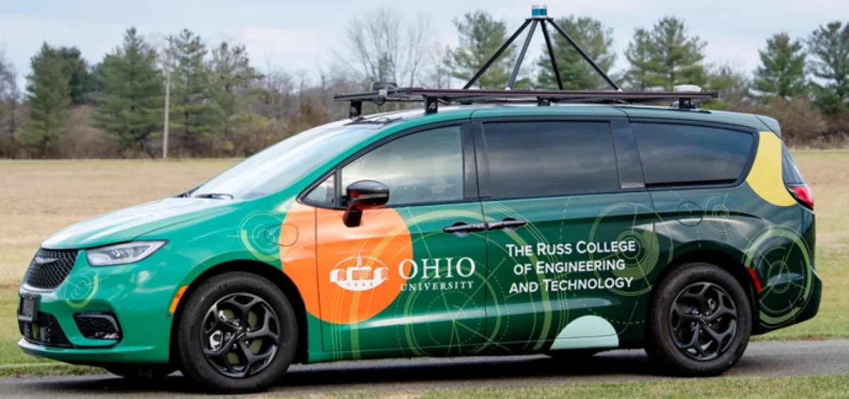
Jay Wilhelm is an associate professor of mechanical engineering and an affiliate of the Ohio Research Institute for Transportation and the Environment at Ohio University’s Russ College of Engineering and Technology. His research focuses on self-driving cars and autopilots for drones, which includes testing autonomous vehicles in southeast Ohio.
He sat down to speak with WOUB’s David Forster for “Modern Science.”
This interview has been edited for brevity and clarity.
On the challenges of self-driving cars in southeast Ohio
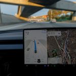
“[Self-driving cars] can only drive on routes that have already driven and mapped out really well. They have really great access to GPS and cellular networks. When you bring that type of car to southeast Ohio, you lose all of that. What we’ve been trying to do is drive in environments that are unlike where cars are being tested now.”
How they are pulling from new sources to map out our roads
“So rural, hilly Appalachia versus urban environments, you need to be connected to the internet because we rely on GPS corrections. Normally GPS is about 16 feet or so in terms of accuracy. Any day you could drive on a road and you’re looking at the same map, you’re plus or minus 16 feet in any direction at that point.
“So we need this other information that Ohio has, this network they called CORS that has corrections information. We get that from the cell network and we inject that in. We go down to about a half inch to a quarter inch of accuracy.”
On what improvements are needed to overcome challenges of self-driving cars in southeast Ohio
“It mainly comes down to infrastructure or technology. Do we make cell phone [access] everywhere or do we improve our technology so that we can operate better?
“If we put cell phone towers everywhere, that may not be feasible because of the terrain in southeast Ohio. In a flatter area popping up towers, they get miles of range. Southeast Ohio, you may only get a couple hundred yards of range, so there would have to be way more of them. The mountains are the issue.
“We’re like, let’s throw more technology at it. Let’s use the cameras. We have a LiDAR sensor on the top, which is light detection and ranging. If we could use those other sensors that are really just being used to sense our environment so that we don’t crash into things or to do simple stuff like lane tracking, we can enable better positioning.”
The first draft of the transcript used for this story was created in Adobe Podcast, which includes an AI transcription tool. A WOUB news editor then reviewed, corrected and reformatted the transcript before publication.

GIPHY App Key not set. Please check settings